
MindFusion.Mapping for WinForms(英語版)
マップを作成、カスタマイズ、表示するための機能を満載
MindFusion Group 社の製品
2003 年より日本国内にてComponentSourceで販売中。
価格:¥ 62,260 (税込)〜 バージョン: 2.0 更新日: Nov 3, 2015
マップを作成、カスタマイズ、表示するための機能を満載
MindFusion Group 社の製品
2003 年より日本国内にてComponentSourceで販売中。
価格:¥ 62,260 (税込)〜 バージョン: 2.0 更新日: Nov 3, 2015
 のスクリーンショット")
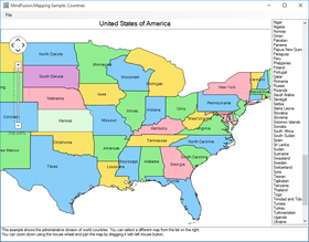
MindFusion.Mapping for WinForms can load, customize and display any type of regional, national or world map. Map data can be loaded from ESRI shapefiles and it includes data for any country in the world as well for selected cities, rivers, roads and other geographic objects. Data for the attributes of map elements can be loaded from a DBF file associated with each map. It's also possible to load OpenStreetMap XML files to display city and road maps. The control supports multiple layers so you can show several maps in a single view.

MindFusion.Mapping for WinForms Features
MindFusion.Mapping for WinForms(英語版)は、次の製品にも含まれています。
今すぐ MindFusion Group ライセンススペシャリストとライブ チャット。


電話: (888) 850 9911
Fax: +1 770 250 6199


